Skip to content
  • Map
  • Route Finder
  • Route Planner
  • Travel Guide
  • Community
Sign up or log in
  • Map
  • Route Finder
  • Route Planner
  • Travel Guide
  • Community
Sign up
  • Places & Accommodation
    • Places to visit
    • Eat & drink
    • Huts
    • Accommodation
    • Ski resorts
    • Crags
  • News & Conditions
    • Current Conditions
    • Weather
    • Webcams
    • Avalanche Report
    • Events
  • Inspiration
    • Collections
    • Offers
    • Travel Stories
    • Publications
  • Community
    • Challenges
    • Groups
  • Settings
  • Help-Center
  • Terms and conditions
  • Privacy policy
  • Legal Disclosure
Travel Guide Germany Lower Saxony Naturpark Harz
more
  • Rock formation Teufelsmauer
    Rock formation Teufelsmauer Photo: Susagep, CC BY-SA, Wikimedia Commons

Naturpark Harz

A Nature Park is a protected landscape that has been preserved in its present state by means of long-term planning and agriculture and is promoted in terms of tourism.

Area: 702.23 km²
Find out more
Digitize the Planet e.V.  Verified partner 
Author of this page
LogoDigitize the Planet e.V.

Activities in Naturpark Harz


hikes
road cycling routes
mountain biking trails
bike rides
long-distance hikes
cross-country ski trails
nature trails winter hikes trail runs scenic routes motorcycle routes runs bikepacking routes gravel bike routes mountain hikes sledding runs horse rides ski tours caravan trips Ski resorts snowshoe walks Crags pilgrim walks city walks alpine routes

Attractions in Naturpark Harz


Highlights

  • My Map
  • Content
  • Show images Hide images
Features
Maps and trails
Discover
Nature Trail · Clausthal-Zellerfeld
World Heritage Discovery Route: On the Trail in the Große Clausthal
Toprecommended route Difficulty easy
Distance 3.4 km
Duration 0:55 h
Ascent 57 m
Descent 62 m

An exciting discovery route into the Große Clausthal. Fantastic views of the wonderful landscape, mysterious ruins, and magnificent buildings from ...

6
from Manuela Armenat,   UNESCO-Welterbe im Harz
Hiking Trail · Harz
From Steinkirche and Einhornhöhle to Scharzfels castle ruins
PremiumPremium content Difficulty easy
Distance 9.1 km
Duration 3:15 h
Ascent 353 m
Descent 353 m

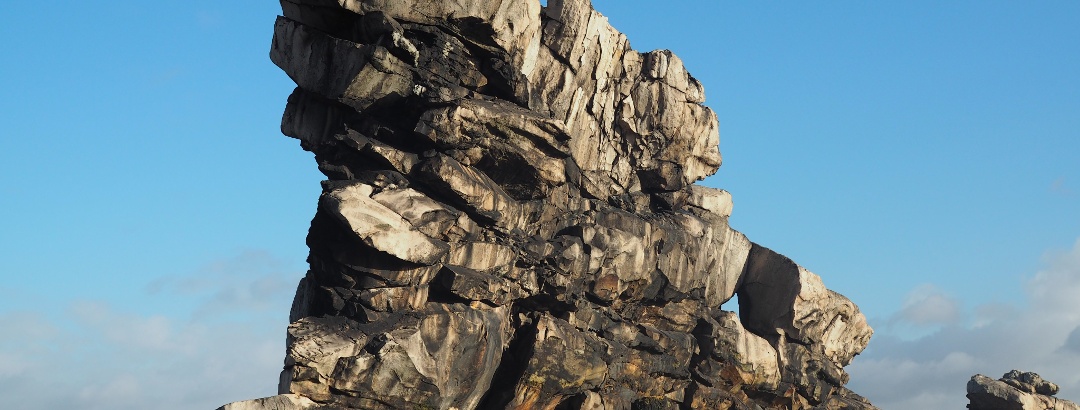
Beautiful hike through the wooded southern edge of the Upper Harz with highlights such as the Steinkirche, the Einhornhöhle, and the Scharzfels ...

1
from Wiebke Hillen,   Outdooractive Premium
Nature Trail · Harz
World Heritage Discovery Trail: Pumping and Storing
Toprecommended route Difficulty easy
Distance 3.3 km
Duration 0:50 h
Ascent 67 m
Descent 67 m

This UNESCO World Heritage discovery trail is about water and energy through hydropower. Discover important technical installations around the ...

3
from Manuela Armenat,   UNESCO-Welterbe im Harz
Hiking Trail · Harz
Steinway-Trail
Toprecommended route Difficulty difficult
Distance 17.1 km
Duration 4:45 h
Ascent 402 m
Descent 459 m

Heinrich Engelhard Steinweg was born in 1797 in Wolfshagen in the Harz. As a master carpenter, he came to Seesen in 1825 to work there.

1
from Harzer Tourismusverband,   Harz: Magische Gebirgswelt
Long-Distance Hiking · Binnenland Schleswig-Holstein
European long-distance path E6 – German section from Flensburg to the Bavarian Forest
PremiumPremium content Difficulty difficult
Distance 1,455.2 km
Duration 369:45 h
Ascent 16,973 m
Descent 15,746 m

The European long-distance path E6 is an ambitious project that is intended to run continuously from northern Finland to Turkey. On the German ...

2
from Matthias Stiel,   Outdooractive Premium
Hiking Trail · Harz
Harzer BaudenSteig 2: From Lerbach to Sieber
Toprecommended route Difficulty moderate Stage 2
Distance 19.5 km
Duration 6:00 h
Ascent 689 m
Descent 686 m

From Lerbach past the Söse reservoir, up over the Acker into the Harz National Park. The Hanskühnenburg invites you to rest before the descent to ...

2
from Harzer Tourismusverband,   Harz: Magische Gebirgswelt
Hiking Trail · Harz
Harzer BaudenSteig 1: From Bad Grund to Lerbach
Toprecommended route Difficulty moderate Stage 1
Distance 21.6 km
Duration 6:35 h
Ascent 512 m
Descent 501 m

From Bad Grund past the Albertturm and the Kuckholzklippe with a wonderful view to Lerbach.

1
from Harzer Tourismusverband,   Harz: Magische Gebirgswelt
Hiking Trail · Harz
Harzer BaudenSteig 3: From Sieber to Bad Lauterberg
Toprecommended route Difficulty moderate Stage 3
Distance 14.7 km
Duration 5:00 h
Ascent 620 m
Descent 655 m

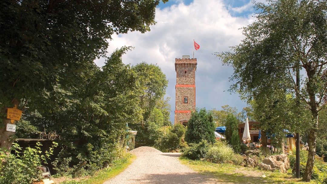
Three mountain huts, two observation towers and all in one day. You should also enjoy the varied landscape.

1
from Harzer Tourismusverband,   Harz: Magische Gebirgswelt
Hiking Trail · Harz
Ways to the Brocken - Teufelsstieg
Toprecommended route Difficulty difficult
Distance 23.8 km
Duration 7:00 h
Ascent 760 m
Descent 963 m

Just under a 25-kilometer hike from Elend via the Brocken to Bad Harzburg.

6
from Harzer Tourismusverband,   Harz: Magische Gebirgswelt
Hiking Trail · Naturpark Harz
Bad Sachsa to the Cistercian Museum Monastery Walkenried
Toprecommended route Difficulty easy
Distance 5.7 km
Duration 1:30 h
Ascent 37 m
Descent 63 m

Friedwald – Angel Ponds Blumenberg – Sachsenburg Ruins – Priorteich – Geiersberg – Cistercian Museum Monastery Walkenried

1
from Harzer Tourismusverband,   Harz: Magische Gebirgswelt
Discover more
  • My Map
  • Content
  • Show images Hide images
Features
Maps and trails
Discover

Discover the region

Accommodation
places to eat and drink
Webcams
huts
offers

Trip planning


Weather

10-day forecast

Webcams

  • Webcams · Harz
    Braunlage › North-West
  • Webcams · Harz
    Braunlage: Hexenexpress - Wurmberg
  • Webcams · Harz
    Braunlage: Hexenritt-Alm - Wurmberg
  • Webcams · Harz
    Braunlage: Nordhang - Wurmberg
  • Webcams · Harz
    Braunlage: Zentrum 2
  • Webcams · Harz
    Braunlage › North: Wurmberg
  • Webcams · Harz
    Langelsheim: Wolfshagen - Nordblick
  • Webcams · Harz
    Clausthal-Zellerfeld
  • Webcams · Harz
    Goslar › South
  • Webcams · Harz
    Langelsheim: Wolfshagen - Westblick
  • Webcams · Harz
    Goslar: Hahnenklee
Show all Webcams in Naturpark Harz

Reviews

  1,782
129 Welt Wald by Gerd
October 18, 2025 · Community
Comment
Oderbrück - Brocken by MT
September 20, 2025 · Community
Sehr schöne Tour, tolle Mischung aus Landschaftserlebnis und Trailspaß. Genau das was ich gesucht hab. Zeitangabe von 3h (reine Fahrzeit) passt für normale Fahrweise. Fahrtechnik sollte wie beschrieben vorhanden sein. Die Querung nach Süden hinter der Wurmbergabfahrt wird nicht oft begangen/gepflegt. Ist zwar durchgehend fahrbar, aber öfters starke Vegetation und Totholz auf dem Weg, eventuell schon einen der größeren Wege vorher nach Süden abbiegen (s. Karte). Achtermann unbedingt (zu Fuß) Mitnehmen, schöner Aussichtspunkt. Tourabschluss an der Kaffeeklappe in Oderbrück ist auch super. Vielen Dank für's teilen der Tour!
More Show less
Comment
Wurmberg summit route by Hartmut
September 19, 2025 · Community
Schöne Route,der Aufstieg lohnt sich. Tolle Aussicht.
More Show less
Route done on September 04, 2025
Photo: Hartmut Schulz, Community
Comment
Show more Show less

Destinations in Naturpark Harz


Nature regions

  • Nature protection area
    Nature protection area · Lower Saxony
    Bergwiesen bei St. Andreasberg
  • Fauna-Flora-Habitat area
    Fauna-Flora-Habitat area · Lower Saxony
    Gipskarstgebiet bei Bad Sachsa
  • Fauna-Flora-Habitat area
    Fauna-Flora-Habitat area · Lower Saxony
    Bergwiesen bei St. Andreasberg
  • Nature protection area
    Nature protection area · Lower Saxony
    Bachtäler im Oberharz um Braunlage
  • Fauna-Flora-Habitat area
    Fauna-Flora-Habitat area · Lower Saxony
    Bergwiesen und Wolfsbachtal bei Hohegeiß
  • Small water region
    Germany
    Innerstetalsperre
  • Fauna-Flora-Habitat area
    Fauna-Flora-Habitat area · Lower Saxony
    Bergwiesen und Teiche bei Zellerfeld
  • Landscape Protection Area
    Landscape Protection Area · Lower Saxony
    Bergwiesen und Wolfsbachtal bei Hohegeiß
  • Nature protection area
    Nature protection area · Lower Saxony
    Naturschutzgebiet Staufenberg
  • Nature protection area
    Nature protection area · Lower Saxony
    Oberharz
  • Mountain range
    Harz Mountains
  • Landscape Protection Area
    Landscape Protection Area · Lower Saxony
    Harz (Landkreis Goslar)
  • Nature protection area
    Nature protection area · Lower Saxony
    Wurmberg
  • Special Protection Area
    Special Protection Area · Lower Saxony
    Klippen im Okertal
  • Nature protection area
    Nature protection area · Lower Saxony
    Siebertal
  • Nature protection area
    Nature protection area · Lower Saxony
    Johanneser Bergwiesen
  • Small water region
    Germany
    Sösetalsperre
  • Fauna-Flora-Habitat area
    Fauna-Flora-Habitat area · Lower Saxony
    Oberharzer Teichgebiet
  • Nature protection area
    Nature protection area · Lower Saxony
    Blockschutthalden am Rammelsberg
  • Small water region
    Germany
    Granetalsperre
  • Fauna-Flora-Habitat area
    Fauna-Flora-Habitat area · Lower Saxony
    Bachtäler im Oberharz um Braunlage
  • Fauna-Flora-Habitat area
    Fauna-Flora-Habitat area · Lower Saxony
    Staufenberg
  • Special Protection Area
    Special Protection Area · Lower Saxony
    Südharz bei Zorge
  • Fauna-Flora-Habitat area
    Fauna-Flora-Habitat area · Lower Saxony
    Felsen im Okertal
App Store
Google Play Store
Huawei App Gallery
  • Our services
    • Features
    • Subscriptions
    • Pro for Search & Rescue
    • Enjoy great benefits and discounts from our partners
    • Vouchers
    • B2B
  • More services
    • Help Center
    • Blog (German only)
    • Newsletter
    • Affiliate Program
    • Contact Us
  • Corporate
    • Discover Outdooractive
    • Outdooractive30
    • Careers
    • Outdooractive Business
Learn more about the apps for Android and iOS
1% for the Planet
Choose a language
English
  • Deutsch
  • italiano
  • français
  • español
  • עברית
  • 中文
  • română
  • português (Portugal)
  • português (Brasil)
  • čeština
  • suomi
  • русский
  • magyar
  • norsk bokmål
  • slovenčina
  • Nederlands
  • 日本語
  • українська
  • हिन्दी
  • Türkçe
  • Ελληνικά
  • Mobile version
  • Terms and conditions
  • Privacy policy
  • Cancellation policy
  • Customer information
  • Terms of payment
  • Map information
  • Legal Disclosure
  • Accessibility