Skip to content
  • Map
  • Route Finder
  • Route Planner
  • Travel Guide
  • Community
Sign up or log in
  • Map
  • Route Finder
  • Route Planner
  • Travel Guide
  • Community
Sign up
  • Places & Accommodation
    • Places to visit
    • Eat & drink
    • Huts
    • Accommodation
    • Ski resorts
    • Crags
  • News & Conditions
    • Current Conditions
    • Weather
    • Webcams
    • Avalanche Report
    • Events
  • Inspiration
    • Collections
    • Offers
    • Travel Stories
    • Publications
  • Community
    • Challenges
    • Groups
  • Settings
  • Help-Center
  • Terms and conditions
  • Privacy policy
  • Legal Disclosure
Travel Guide Taunus Mountain Range
more
  • Der Feldberg bei Nebel.
    Der Feldberg bei Nebel. Photo: Taunus Touristik Service, Outdooractive Editors

Taunus Mountain Range

The Taunus is a German low mountain range in the federal states of Hesse and Rhineland-Palatinate. The popular excursion area surprises with a partly very original nature in direct neighbourhood to cities like Frankfurt, Mainz, Wiesbaden and Koblenz. The best known and highest mountain of the densely wooded area is the Großer Feldberg with 879 m height. Hikers, cyclists, people seeking peace and quiet as well as nature and culture lovers visit the area for a break from everyday life.
Find out more
Outdooractive Editors  Verified partner 
Author of this page
LogoOutdooractive Editors

Activities in the Taunus Mountain Range


View of St. Goarshausen
road cycling routes
hikes
mountain biking trails
bike rides
long-distance hikes
runs
trail runs horse rides bikepacking routes scenic routes pilgrim walks nature trails mountain hikes gravel bike routes Crags motorcycle routes caravan trips sledding runs city walks

Attractions in the Taunus Mountain Range


Highlights

  • My Map
  • Content
  • Show images Hide images
Features
Maps and trails
Discover
Hiking Trail · Taunus Mountain Range
Kurschatten (Bad Schwalbach), Wisper Trail 16
Toprecommended route Difficulty easy
Distance 6.8 km
Duration 2:02 h
Ascent 400 m
Descent 400 m

Short hike near Bad Schwalbach with variations

2
from Kerstin Brill,   alpenvereinaktiv.com
Hiking Trail · Taunus Mountain Range
Heftrich Moor - Schlossborn - Glashütten - Limes
Toprecommended route Difficulty moderate
Distance 13.5 km
Duration 4:00 h
Ascent 244 m
Descent 244 m

The hike in the Rhein-Taunus Nature Park leads from Heftrich Moor to Schlossborn and up to the slopes of Glaskopf. Through the Hochtaunus town of ...

13
from Wolfgang Gurk,   alpenvereinaktiv.com
Hiking Trail · Kronberg in the Taunus
Rundwanderung von Kronberg zum Kronthaler Quellenpark
Toprecommended route Difficulty T1 easy
Distance 6.3 km
Duration 2:00 h
Ascent 151 m
Descent 151 m

Sehr abwechslungsreicher Weg, beginnend mit Kronbergs Altstadt, weiter durch Esskastanienwälder und zu den historischen Heilquellen.

1
from Wolfgang Gurk,   alpenvereinaktiv.com
Hiking Trail · Taunus
Schwälbchen's Flight (Schlehborner Heide), Wisper Trail 11
Toprecommended route Difficulty easy
Distance 10.8 km
Duration 3:00 h
Ascent 302 m
Descent 220 m

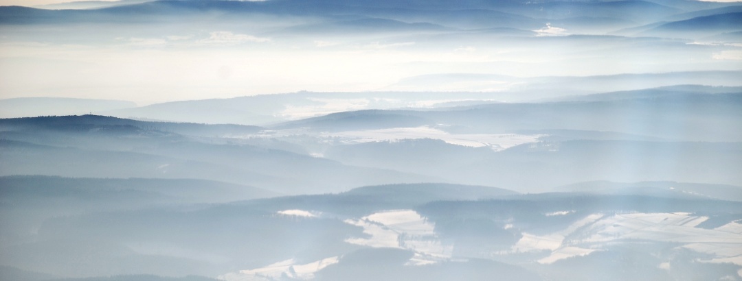
Varied hike between Langenseifen and Ramschied with wide views and through forest sections

1
from Kerstin Brill,   alpenvereinaktiv.com
Hiking Trail · Taunus Mountain Range
Circular hike from the Fasanerie (near Wiesbaden) via Schläferskopf and the Altenstein
Toprecommended route Difficulty easy
Distance 15.9 km
Duration 4:30 h
Ascent 330 m
Descent 334 m

The circular hike leads through extensive Taunus forests. Significant parts of the ascent and descent follow brook meadow valleys.

8
from Wolfgang Gurk,   alpenvereinaktiv.com
Hiking Trail · Wetzlar
Wetzlar 3-Towers-Route
Toprecommended route Difficulty moderate
Distance 20.4 km
Duration 6:30 h
Ascent 358 m
Descent 357 m

Nature and culture around Wetzlar! Spectacular views and a fascinating cultural landscape on the route from tower to tower of the medieval city ...

3
from Jörg Thamer,   Lahntal Tourismus Verband e. V.
Long-Distance Hiking
The Rheinsteig
PremiumPremium content Difficulty moderate Multi-day route
Distance 327.5 km
Duration 102:00 h
Ascent 10,093 m
Descent 10,064 m

On varied paths, the Rheinsteig leads through the narrow valleys of the Rhine. Between Bonn, Koblenz, and Wiesbaden, spectacular views of the ...

1
ADAC Wanderführer
Hiking Trail · Taunus Mountain Range
Der Überhöhische (Fischbach), Wisper Trail 12
Toprecommended route Difficulty moderate
Distance 15.2 km
Duration 4:15 h
Ascent 285 m
Descent 285 m

Varied hike around Fischbach, where we enjoy the views around Hausen and get to know Fischbach from different perspectives

3
from Kerstin Brill,   alpenvereinaktiv.com
Hiking Trail · Taunus Mountain Range
Circular hike between Wiesental and Eschbacher Klippen
Toprecommended route Difficulty
Distance 19.4 km
Duration 5:00 h
Ascent 470 m
Descent 470 m

In the eastern Hintertaunus, the hike mostly leads through forest and quiet brook valleys. Some open areas offer beautiful views of the heights of ...

9
from Wolfgang Gurk,   alpenvereinaktiv.com
Hiking Trail · Taunus Mountain Range
Wispertalsteig (Espenschied), Wisper Trail 5
Toprecommended route Difficulty moderate
Distance 14.6 km
Duration 4:30 h
Ascent 480 m
Descent 480 m

Challenging hike from Espenschied with views over the heights and beautiful sections in the forest including two descents, into the Wispertal and ...

6
from Kerstin Brill,   alpenvereinaktiv.com
Discover more
  • My Map
  • Content
  • Show images Hide images
Features
Maps and trails
Discover

Discover the region

Dog-friendly hiking
Accommodation
places to eat and drink
Accessibility
Webcams
offers
Show more Show less

Borders and subdivision of the Taunus

The Taunus belongs as part of the Rhenish Slate Mountains to the older mountains of Germany. The low mountain range is bordered by the Upper Middle Rhine Valley in the west, the Lahn Valley with the Limburg Basin in the north, the Giessen Basin and the Wetterau in the east, and the Rheingau and Main-Taunus foothills in the south.

The Taunus itself is in turn divided into different parts of the landscape. The southern part of the mountain range is described as Anterior Taunus and High Taunus and is characterized by higher parts as well as strong forestation. North of it is the Hintertaunus, a less mountainous landscape with deep valleys and distinct plateaus. This area is also used more agriculturally. The Idstein Dip divides the northern area again into western and eastern Hintertaunus.

Historical traces in the Taunus

The Taunus has been settled for many centuries. Legacies of the former people still bear witness to their lives today. The Upper German-Raetian Limes stretched over the Taunus main ridge from the 1st to the 3rd century. The partly still visible border wall has been a UNESCO world heritage site since 2005. Along the Limes there were several forts, of which the Saalburg fort near Bad Homburg can still be visited today. On the Limes hiking trail you can follow the historical traces especially well.

In the Middle Ages, numerous castles and palaces were added to the landscape of the Taunus Mountains. Some of the most beautiful and best-preserved buildings can be found in the region. The "Hessian fairy tale castle" Braunfels, the castle ruins Freienfels near Weinbach with its annual knights' games and the former residential castles in Bad Homburg and Weilburg are only a few of the rich medieval building landscape.

  • Hiking Trail · Taunus
    On the Limes hiking trail
  • Museum · Taunus
    Saalburg = Station der Deutschen Limes-Straße

Exploring the Taunus

The Taunus can be explored in different ways. The low mountain range is particularly popular with excursionists from the Rhine-Main region for hikes, bike tours, great views or just a nose full of fresh air. On the extensive network of hiking trails, you can discover not only nature worth seeing, but also cultural monuments along the way. Cyclists are sporty on the move in the High Taunus Mountains – the valleys of Weil, Aar, Ems- and Wörsbach as well as the Anterior Taunus are ideal for leisurely routes. Mountain bikers will be delighted with the bike park at the Großer Feldberg, which offers two challenging routes. One highlight is certainly the Hochtaunusstraße, a 55 km long vacation road. Here on the way you can explore the deep forests, prominent peaks, wide valleys, beautiful places and long gone cultures in a relaxed way.
Scenic Route
Hochtaunusstraße
Difficulty
Distance 44.3 km
Duration 0:41 h
Ascent 694 m
Descent 694 m

from Klaus-Peter Hausberg,   FERIENSTRASSEN.INFO

Trip planning


Weather

10-day forecast

Current Conditions

since November 12, 2024 · Taunus Mountain Range
Tree death in the area of the local community of Reckenroth

Webcams

  • Webcams · WIESBADEN RHEINGAU
    Wiesbaden: Wiesbadener Golf Club e.V. - Chausseehaus
  • Webcams · Taunus
    Konigstein im Taunus › South-West: Frankfurt am Main I
  • Webcams · Taunus
    Usingen › North-West
  • Webcams · Taunus
    Hahn: Taunusstein
  • Webcams · Taunus
    Kemel › South-West: Heidenrod
  • Webcams · Taunus
    Idstein › South-West: Idstein(Taunus)
  • Webcams · Taunus
    Wehrheim: i. Ts. - Mitte
  • Webcams · Taunus
    Wehrheim › East: Flugplatz Anspach/Taunus (EDFA): Apron East
  • Webcams · Taunus
    Schmitten: Großer Feldberg - Taunus
  • Webcams · Taunus
    Wehrheim › North: Flugplatz Anspach/Taunus (EDFA): Apron North
  • Webcams · Taunus
    Konigstein im Taunus › South-West
  • Webcams · Taunus
    Butzbach: Hausbergturm
Show all Webcams in the Taunus Mountain Range

Reviews

  1,927
Weilrod - Vogelburg - From Weilrod to Haselbach by Daniel Hirsch
2 days ago · Community
Eine Tour, die sehr schön ist. Und vor allem die Vogelburg ist eine absolute Empfehlung. Auch direkt anfahrbar ist diese auch. Video meiner Tour ist da zu finden: <a href="https://youtu.be/lGLLpNblwAA" class="oax_externallink" target="_blank" rel="nofollow noopener">https://youtu.be/lGLLpNblwAA</a>
More Show less
Comment
Rhein 6 - Scenic adventure route around Nochern by Christian
October 26, 2025 · Community
Wieder eine unvergessliche Abenteuertour von Euch. Die Klettereinlagen und der Kraxelspass machen die Runde zum top Erlebnis. Vielen Dank 😀. Ich hoffe, Ihr macht es nicht eines Tages wie Mr. Pfade und verlangt „Eintritt“ für Eure Touren. Verdient hättet Ihr es wohl 😃. Viele Grüße Christian
More Show less
Photo: Christian, Community
1 comment
Bad Camberg - Baunwipfelpfard by Daniel Hirsch
October 26, 2025 · Community
Eine wirklich schöne Rundwanderung. Wer diese nicht machen möchte, kann auch vor Ort beim Baumwipfelpfad parken.
More Show less
Route done on October 25, 2025
Comment
Show more Show less

Destinations in the Taunus Mountain Range


Nature regions

  • Nature park
    Nature park · Rhineland-Palatinate
    Nassau Nature Park
  • Nature park
    Nature park · Hesse
    Rhein-Taunus
  • Nature park
    Nature park · Hesse
    Hochtaunus
THE way to start your next outdoor experience!
Sign up now
App Store
Google Play Store
Huawei App Gallery
  • Our services
    • Features
    • Subscriptions
    • Pro for Search & Rescue
    • Enjoy great benefits and discounts from our partners
    • Vouchers
    • B2B
  • More services
    • Help Center
    • Blog (German only)
    • Newsletter
    • Affiliate Program
    • Contact Us
  • Corporate
    • Discover Outdooractive
    • Outdooractive30
    • Careers
    • Outdooractive Business
Learn more about the apps for Android and iOS
1% for the Planet
Choose a language
English
  • Deutsch
  • italiano
  • français
  • español
  • עברית
  • 中文
  • română
  • português (Portugal)
  • português (Brasil)
  • čeština
  • suomi
  • русский
  • magyar
  • norsk bokmål
  • slovenčina
  • Nederlands
  • 日本語
  • українська
  • हिन्दी
  • Türkçe
  • Ελληνικά
  • Mobile version
  • Terms and conditions
  • Privacy policy
  • Cancellation policy
  • Customer information
  • Terms of payment
  • Map information
  • Legal Disclosure
  • Accessibility