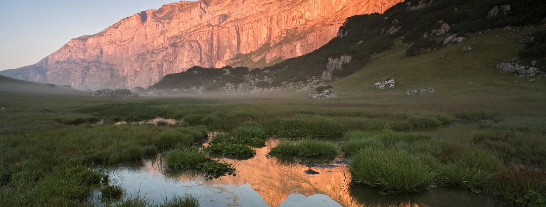
Skip to content
  • Map
  • Route Finder
  • Route Planner
  • Travel Guide
  • Community
Sign up or log in
  • Map
  • Route Finder
  • Route Planner
  • Travel Guide
  • Community
Sign up
  • Places & Accommodation
    • Places to visit
    • Eat & drink
    • Huts
    • Accommodation
    • Ski resorts
    • Crags
  • News & Conditions
    • Current Conditions
    • Weather
    • Webcams
    • Avalanche Report
    • Events
  • Inspiration
    • Collections
    • Offers
    • Travel Stories
    • Publications
  • Community
    • Challenges
    • Groups
  • Settings
  • Help-Center
  • Terms and conditions
  • Privacy policy
  • Legal Disclosure
Travel Guide Rofan Mountains
more
  • Mornings in the Rofan Mountains
    Mornings in the Rofan Mountains Photo: Achensee Tourismus
  • Hiking in the Rofan Mountains
    Hiking in the Rofan Mountains Photo: Achensee Tourismus

Rofan Mountains

The Rofan Mountains are located in the western part of the Brandenberg Alps, between Lake Achensee and Inn Valley. It consists of the main ridge with well-known peaks such as the Klobenjoch, the Hochiss, the Seekarlspitze and the Rofanspitze. The Dalfazer Wände with the Dalfazer Joch and Rotspitze are connected to it. A little farther south is another ridge including the Sagzahn, Sonnwendjoch and Haidachstellwand.
Find out more
Outdooractive Editors  Verified partner 
Author of this page
LogoOutdooractive Editors

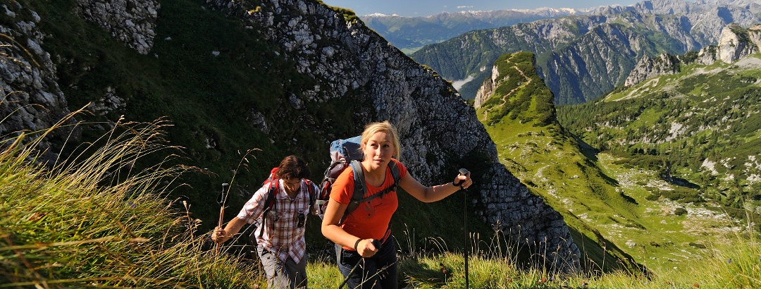
Activities in the Rofan Mountains


hikes
mountain biking trails
mountain hikes
bike rides
road cycling routes
long-distance hikes
bikepacking routes ski tours motorcycle routes winter hikes snowshoe walks trail runs pilgrim walks via ferratas nature trails runs caravan trips cross-country ski trails gravel bike routes alpine climbing routes Crags horse rides sledding runs scenic routes Ski resorts

Attractions in the Rofan Mountains


Highlights

  • My Map
  • Content
  • Show images Hide images
Features
Maps and trails
Discover
Long-Distance Hiking · Rofan Mountains
Circular hike in the Rofan
Toprecommended route Difficulty moderate
Distance 22.5 km
Duration 12:30 h
Ascent 2,210 m
Descent 2,330 m

Three-day circular hike in the Rofan mountains with two hut overnight stays, which impress especially in early summer through landscape and ...

1
from Thomas John,   alpenvereinaktiv.com
Mountain Hike · Rofan Mountains
Guffert - with a circular route over the Luxeggalm
Toprecommended route Difficulty difficult
Distance 11.9 km
Duration 6:15 h
Ascent 1,341 m
Descent 1,341 m

The Guffert, a mighty rock pyramid, dominates the Brandenberg Alps and shows a different appearance from every side. With a circular route over ...

9
from Josef Essl,   alpenvereinaktiv.com
Mountain Hike · Rofan Mountains
Rofanspitze, Sagzahn, and Vorderes Sonnwendjoch
Toprecommended route Difficulty moderate
Distance 10.5 km
Duration 4:00 h
Ascent 764 m
Descent 764 m

Magnificent, large, and extremely scenic round with spectacular views, deep insights, and perspectives.

11
from Cathleen Peer,   alpenvereinaktiv.com
Mountain Hike · Rofan Mountains
Vorderunnütz, circular route from Steinberg
Toprecommended route Difficulty T2 moderate
Distance 14.2 km
Duration 6:30 h
Ascent 1,100 m
Descent 1,100 m

Demanding, little-frequented circular route to a magnificent viewpoint summit

4
from Konrad Kürzinger,   alpenvereinaktiv.com
Hiking Trail · Chiemsee-Alpenland
Around Lake Hechtsee
Toprecommended route Difficulty easy
Distance 3.6 km
Duration 1:15 h
Ascent 54 m
Descent 54 m

Around Lake HechtseeGreat small route past the waterfalls and up the switchbacks to Lake Hechtsee. Along wonderful lakeside paths and pleasant ...

1
from Uwe Stanke,   alpenvereinaktiv.com
Mountain Hike · Rofan Mountains
Hochiss via ferrata, Dalfazer ridge, Rofan mountains/Lake Achensee
Toprecommended route Difficulty difficult
Distance 9.4 km
Duration 5:15 h
Ascent 1,090 m
Descent 1,090 m

Eight peaks in one go. Little frequented ridge crossing with magnificent views down to Lake Achensee; surefootedness and a head for heights required.

1
from Karl Linecker,   alpenvereinaktiv.com
Mountain Biking · Achensee in Tirol
Zillertal Dolomites Lagorai Pasubio Riva
Toprecommended route Difficulty S3 difficult
Distance 452.4 km
Duration 41:00 h
Ascent 15,443 m
Descent 15,880 m

This Transalp route starts in Jenbach and leads through the Zillertal, through the Dolomites, the Lagorai and over the Pasubio to Riva. 

2
from Georg Mayrhofer,   alpenvereinaktiv.com
Hiking Trail · Achensee in Tirol
Kotalm - Köglalm - circular hike
Toprecommended route Difficulty moderate
Distance 9.5 km
Duration 3:30 h
Ascent 730 m
Descent 730 m

A fine hiking tour above Lake Achensee with two mountain huts for resting.

2
from Elisabeth Reder,   alpenvereinaktiv.com
Hiking Trail · Rofan Mountains
Ebner Joch (1957 m) via Astenau Alm
Toprecommended route Difficulty moderate
Distance 8.7 km
Duration 5:00 h
Ascent 1,080 m
Descent 1,080 m

Green, striking gatekeeper at the entrance to Achensee. A premium-class viewpoint mountain.

5
from Michael Larcher,   alpenvereinaktiv.com
Hiking Trail · Rofan Mountains
Zireinersee and Roßkogel from Aschau/Brandenberg
Toprecommended route Difficulty moderate
Distance 18.8 km
Duration 6:30 h
Ascent 980 m
Descent 980 m

Scenic alpine pasture hike to the natural jewel Zireiner See.

1
from Michael Larcher,   alpenvereinaktiv.com
Discover more
  • My Map
  • Content
  • Show images Hide images
Features
Maps and trails
Discover

Discover the region

places to eat and drink
Accommodation
Dog-friendly hiking
Accessibility
huts
Webcams

Trip planning


Weather

10-day forecast

Webcams

  • Webcams · Achensee in Tirol
    Pertisau: Achensee
  • Webcams · Kufsteinerland
    Vorderthiersee: Kufstein - Kaisergebirge
  • Webcams · Alpbachtal
    Gemeinde Munster: Kramsach - Rofan
  • Webcams · Achensee in Tirol
    Gemeinde Achenkirch › South
  • Webcams · Achensee in Tirol
    Gemeinde Achenkirch › North
Show all Webcams in the Rofan Mountains

Reviews

  676
Track Oct 19, 2025 10:01:02 by Daniel
October 19, 2025 · Community
Comment
Vorderes Sonnwendjoch - Sagzahn - Rofanspitze by D
August 13, 2025 · Community
Tolle Tour, aber Achtung, der Klettersteig am Sagzahn wird nicht erwähnt - kann umgangen werden, das kostet aber ca. ne halbe Stunde extra. Evtl. andersrum gehen, dann kann man die Kletterpassage bergauf gehen.
More Show less
Comment
Kaisergebirge 3 Tagestour by Benjamin
July 03, 2025 · Community
Sehr schöne Tour, und sehr empfehlenswert. Jedoch war die geplante Überschreitung (Klettersteig) sehr anspruchsvoll und für manche sicherlich unbewältigbar zu dieser Jahreszeit aufgrund des Schnees. Ich persönlich musste meine langjährige Kletter- und Bergerfahrung einsetzen, um den Klettersteig "umklettern" zu können.
More Show less
Route done on April 24, 2025
Comment
Show more Show less

Groups

Camramblers Walking Club
6 members

Destinations in the Rofan Mountains


THE way to start your next outdoor experience!
Sign up now
App Store
Google Play Store
Huawei App Gallery
  • Our services
    • Features
    • Subscriptions
    • Pro for Search & Rescue
    • Enjoy great benefits and discounts from our partners
    • Vouchers
    • B2B
  • More services
    • Help Center
    • Blog (German only)
    • Newsletter
    • Affiliate Program
    • Contact Us
  • Corporate
    • Discover Outdooractive
    • Outdooractive30
    • Careers
    • Outdooractive Business
Learn more about the apps for Android and iOS
1% for the Planet
Choose a language
English
  • Deutsch
  • italiano
  • français
  • español
  • עברית
  • 中文
  • română
  • português (Portugal)
  • português (Brasil)
  • čeština
  • suomi
  • русский
  • magyar
  • norsk bokmål
  • slovenčina
  • Nederlands
  • 日本語
  • українська
  • हिन्दी
  • Türkçe
  • Ελληνικά
  • Mobile version
  • Terms and conditions
  • Privacy policy
  • Cancellation policy
  • Customer information
  • Terms of payment
  • Map information
  • Legal Disclosure
  • Accessibility