Skip to content
  • Map
  • Route Finder
  • Route Planner
  • Travel Guide
  • Community
Sign up or log in
  • Map
  • Route Finder
  • Route Planner
  • Travel Guide
  • Community
Sign up
  • Places & Accommodation
    • Places to visit
    • Eat & drink
    • Huts
    • Accommodation
    • Ski resorts
    • Crags
  • News & Conditions
    • Current Conditions
    • Weather
    • Webcams
    • Avalanche Report
    • Events
  • Inspiration
    • Collections
    • Offers
    • Travel Stories
    • Publications
  • Community
    • Challenges
    • Groups
  • Settings
  • Help-Center
  • Terms and conditions
  • Privacy policy
  • Legal Disclosure
Travel Guide Carpathians
more
  • Munții Carpați (Munții Tatra, Polonia)
    Munții Carpați (Munții Tatra, Polonia) Photo: Andrzej Rusinowski, CC0, Unsplash
  • Munții Carpați (Munții Piatra Craiului, Romania)
    Munții Carpați (Munții Piatra Craiului, Romania) Photo: Mari Potter, CC0, Unsplash

Carpathians

The Carpathians are a 1,500km-long mountain range in Central Europe, which spans across the Carpathian Basins from the Porta Hungarica to the Iron Gates. Its diverse landscapes have been explored by organized tourism since 1873. You will find many historical monuments along the mountains' beautiful limestone cliffs, while in the volcanic High Tatras lies Gerlachovský, the range's highest peak at 2655 meters.
Find out more
Outdooractive Editors  Verified partner 
Author of this page
LogoOutdooractive Editors

Activities in the Carpathians region


hikes
mountain biking trails
Crags
bike rides
bikepacking routes
long-distance hikes
mountain hikes trail runs nature trails road cycling routes pilgrim walks cross-country ski trails ski tours winter hikes runs motorcycle routes Ski resorts city walks scenic routes alpine routes gravel bike routes snowshoe walks canoe trips kayak trips via ferratas horse rides backcountry skiing routes caravan trips alpine climbing routes horse carriage rides SUP routes

Attractions in the Carpathians region


Highlights

  • My Map
  • Content
  • Show images Hide images
Features
Maps and trails
Discover
Hiking Trail · Weinviertel
A "pepper" route over the Galgenberg from/to Poysdorf
Toprecommended route Difficulty T1 moderate
Distance 15.8 km
Duration 4:15 h
Ascent 332 m
Descent 332 m

Hiking where the pepper grows ... cellar lane, oak forests, a castle view, and extensive vineyards in the core area of the Grüner Veltliner.

1
from Wolfgang Drexler,   alpenvereinaktiv.com
Road Cycling · Bezirk Mistelbach
Buschberg circuit
Toprecommended route Difficulty moderate
Distance 62 km
Duration 3:00 h
Ascent 829 m
Descent 830 m

This demanding round route variant is frequently ridden and only touches the climbs from Schletz and Gnadendorf at Buschberg, but instead conquers ...

1
from Alexander Saritter,   alpenvereinaktiv.com
Bikepacking · Börzsönyvidék
The great volcano circuit, or the faces of Börzsöny
Toprecommended route Difficulty moderate Open
Distance 90 km
Duration 7:39 h
Ascent 1,059 m
Descent 1,059 m

During the two-day tour, we cycle around one of Hungary's wildest mid-mountain ranges, uniquely discovering the Börzsöny's various individually ...

1
from Szigeti Ferenc,   MTSZ - együttműködő szervezetek
Mountain Biking · Transylvania
Straja route
Toprecommended route Difficulty S2 difficult
Distance 47.2 km
Duration 7:20 h
Ascent 1,637 m
Descent 1,646 m

Strenuous great route in the Vâlcan Mountains (SW Carpathians). From Uricani, you go through a long valley to the ridge of the Muntii Vâlcan.

1
from Hermann Böhler,   alpenvereinaktiv.com
Hiking Trail
Capturing castles with summit assaults
Toprecommended route Difficulty moderate Open
Distance 15.6 km
Duration 5:05 h
Ascent 822 m
Descent 822 m

A circular route featuring many sights, with even elevation gain from Mátrafüred to Kékes, including viewpoints, springs, a cave, earthworks, and ...

11
from Dr. Szentes Szilárd,   Magyar Természetjáró Szövetség
Hiking Trail
In the enchantment of springs, quarries, and trains
Toprecommended route Difficulty difficult Open
Distance 12.7 km
Duration 3:40 h
Ascent 449 m
Descent 449 m

Good infrastructure, pleasant forest circular route from Mátrafüred through Lajosháza touching the Cserkő quarry, Farkas-kút, and Sástó lookout.

25
from Dr. Szentes Szilárd,   Magyar Természetjáró Szövetség
Hiking Trail · Börzsönyvidék
Kóspallag circular tour with historical adventures
Toprecommended route Difficulty moderate Open
Distance 14.5 km
Duration 4:00 h
Ascent 246 m
Descent 246 m

This classic circular route guides us through varied landscapes between Kóspallag and Törökmező. The route is enriched by the ruins of Bibervár, ...

11
from Dr. Szentes Szilárd,   Magyar Természetjáró Szövetség
Hiking Trail · Slovakia
In the footsteps of the cobblestone from Somoskő to Ajnácskő
Toprecommended route Difficulty moderate Open
Distance 18.7 km
Duration 5:34 h
Ascent 517 m
Descent 728 m

Starting from the symbolic castle of Somoskő, wandering to the fairy-tale village of Ajnácskő, and following the footsteps of the cobblestone, we ...

1
from Szigeti Ferenc,   MTSZ - együttműködő szervezetek
Hiking Trail · Nízké Tatry
From Donovaly to Zvolen in the Low Tatras
Toprecommended route Difficulty T2 moderate
Distance 5.4 km
Duration 2:30 h
Ascent 436 m
Descent 435 m

Easy circular hike to the scenic summit Zvolen 1403m in the Low Tatras from the parking lot in Donovaly

2
from Ulrich Koppold,   alpenvereinaktiv.com
Hiking Trail · Dunazug-hegyvidék
Beautiful view: Kevély loop with extras
Toprecommended route Difficulty moderate
Distance 21.7 km
Duration 6:31 h
Ascent 636 m
Descent 636 m

The circular route starting from Csillaghegy in District III, which also includes the Róka-hegy quarry, leads to the Kevélyek, where we tried to ...

8
from Tenczer Gábor,   Magyar Természetjáró Szövetség
Discover more
  • My Map
  • Content
  • Show images Hide images
Features
Maps and trails
Discover

Discover the region

Dog-friendly hiking
Webcams
places to eat and drink
huts
Accessibility
offers

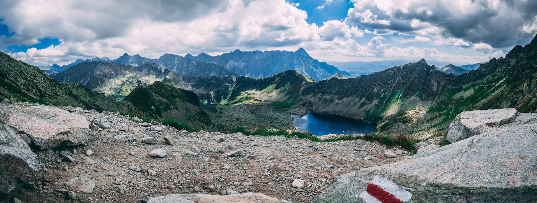
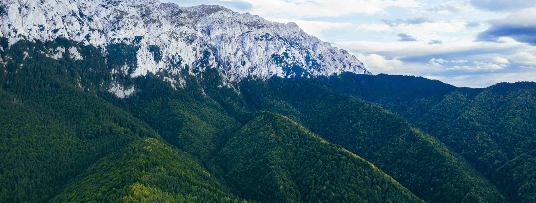
The Colorful Carpathians

The Carpathians form an expansive arch over the Danube. Their uniqueness stems from this articulation, creating a landscape that is both wildly diverse and ripe for exploration. In the Carpathians you will find extinct volcanoes, castles clinging to limestone clifftops, untouched nature, soaring ridges, and many other hidden treasures. Being lower than the neighboring Alps means that the Carpathians generally require less in the way of mountain experience while ensuring hikers can still enjoy diversity, wildness and adventure. In addition to their natural beauty, many ethnic groups have also settled in the mountains bringing with them colorful villages, historical and cultural sites and a unique set of traditions that further decorate and enrich this fabulous corner of the world to provide an unforgettable experience to any visitor. 
Sunrise in the Carpathians
Photo: Vlad Kiselov, Unsplash
The Carpathians run through the Czech Republic, Slovakia, Poland, Hungary, Ukraine, Romania and Serbia, making it hardly a surprise that they are known by many different names. It is worth pointing out that alongside the narrowly construed 'Carpathians' themselves, lie the regions of the Apuseni Mountains, the Transylvanian Basin, and the Banatulu mountains.
The dam at the Drăgan river
Photo: Paul Mocan, Unsplash

Destinations in the Carpathians region


Nature regions

  • National park
    National park
    Cozia National Park
  • Nature park
    Nature park
    Putna - Vrancea Natural Park
  • National park
    National park
    Rodna Mountains National Park
  • National park
    National park · Közép-Magyarország
    Duna–Ipoly Nemzeti Park
  • Nature park
    Nature park
    Apuseni Natural Park
  • Nature park
    Nature park
    Iron Gates Natural Park
  • National park
    National park
    Piatra Craiului National Park
  • Nature park
    Nature park · Észak-Magyarország
    Zempléni Tájvédelmi Körzet
  • National park
    National park
    Buila - Vânturarița National Park
  • Nature park
    Nature park · Észak-Magyarország
    Mátrai Tájvédelmi Körzet
  • Nature park
    Nature park
    The Țara Hațegului Dinosaurs Geopark
  • Mountain group
    Munţii Sibiului
  • Nature park
    Nature park
    Mehedinți Plateau Geopark
  • National park
    National park
    Ceahlău National Park
  • National park
    National park
    Cheile Nerei - Beușnița National Park
  • National park
    National park
    Retezat National Park
  • Nature park
    Nature park
    Gradiștea Muncelului - Cioclovina Natural Park
  • National park
    National park · Észak-Magyarország
    Bükki Nemzeti Park
  • Mountain group
    Munţii Ciucaş
  • National park
    National park
    Calimani National Park
  • Nature park
    Nature park
    Bucegi Natural Park
  • National park
    National park
    The Domogled - Cerna Valley National Park
  • Nature park
    Nature park · Észak-Magyarország
    Karancs-Medves Tájvédelmi Körzet
  • National park
    National park
    Semenic - Caraș Gorges National Park
THE way to start your next outdoor experience!
Sign up now
App Store
Google Play Store
Huawei App Gallery
  • Our services
    • Features
    • Subscriptions
    • Pro for Search & Rescue
    • Enjoy great benefits and discounts from our partners
    • Vouchers
    • B2B
  • More services
    • Help Center
    • Blog (German only)
    • Newsletter
    • Affiliate Program
    • Contact Us
  • Corporate
    • Discover Outdooractive
    • Outdooractive30
    • Careers
    • Outdooractive Business
Learn more about the apps for Android and iOS
1% for the Planet
Choose a language
English
  • Deutsch
  • italiano
  • français
  • español
  • עברית
  • 中文
  • română
  • português (Portugal)
  • português (Brasil)
  • čeština
  • suomi
  • русский
  • magyar
  • norsk bokmål
  • slovenčina
  • Nederlands
  • 日本語
  • українська
  • हिन्दी
  • Türkçe
  • Ελληνικά
  • Mobile version
  • Terms and conditions
  • Privacy policy
  • Cancellation policy
  • Customer information
  • Terms of payment
  • Map information
  • Legal Disclosure
  • Accessibility